What We Do
Remote Sensing
We Assess impact and allocate resources quickly with before, during, and after disaster satellite imagery, anywhere on Earth.
GIS
We develop automated applications that perform location-analytics on different types of spatial and non-spatial data.
Artificial Intelligence
We Combine spatial data with intelligent machine-learning algorithms to discover trends and automate predictions.

About Us
At SpaceIn, we believe that scalable spatial technologies can unlock the potential of geodata and deliver location-based solutions in organizations across all industries. With our extensive geospatial and machine learning capabilities combined with progressive methodologies, we can enable your business get insights for better business decisions. We are also committed to serving clients with professionalism and expertise, and in identifying strongly with their outcome. This sense of responsibility means we always strive to add value and are pro-active in solving problems and in adopting emerging technologies.
Services
We offer professional geospatial solutions for government organizations and business.
Remote Sensing
Assess impact and allocate resources quickly with before, during, and after disaster satellite imagery, anywhere on Earth.
Business Intelligence
Combine demographic, lifestyle and customer data with location-based analytics for accurate business insights.
Geo AI
Combine spatial data with intelligent machine-learning algorithms to discover trends and automate predictions.
GIS Database Design
Develop versatile geodatabases through the use of industry-standard database models, tools and software.
Automated GIS Solutions
We develop automated applications that perform location-analytics on different types of spatial and non-spatial data.
GIS & RS Training
Equip your employees with skills on emerging technologies such as Geo AI and how to leverage them to elevate your business.
Projects
Below are our most recent projects.
- All
- Coral Sense
- FireMapper
- WeedTrac
- PropUtils
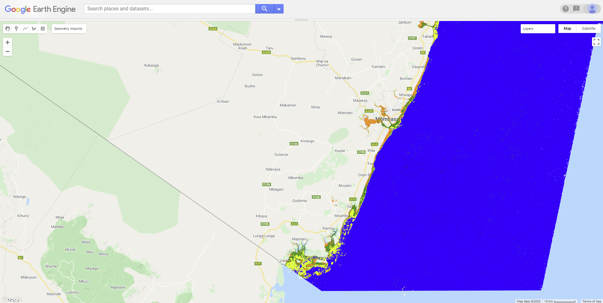
Marine Ecosystem Monitoring
A cloud-based computing program that automates general mapping of benthic habitat on the go that can be used to monitor changes in the habitats below water. The application provides baseline data for marine ecosystem monitoring.
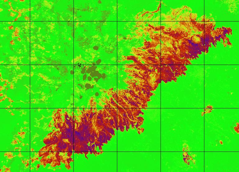
Forest Fires Impact Evaluation
Cloud based application for rapid assessment of spatial extent and severity of fire. The application can be used to asses damage to vegetation, biodiversity and nearby property/population.
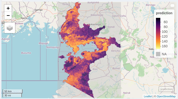
Invasive Species Modeling
We've developed a machine-learning based tool that can enable organizations to actively monitor and model invasive species spread over different geographical regions.
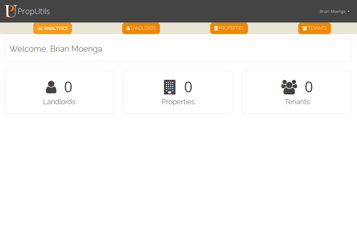
Property Management System
A web-based platform that eases the management of properties for landlords and other property stakeholders. The application allows users view property analytics, manage tenants and properties and define property landlords.
Team
We are a group of talented problem solvers, bringing together a diverse skillset in different modern geospatial technologies including AI, Remote Sensing, and GIS.

Ahmed Fuad
GIS Administration Expert
Derick Ongeri
Earth Observation Analyst
Japheth Nyandoro
Machine Learning EngineerContact
Here at SpaceIn, we're dedicated to making our clients happy. If you have a question, inquiry or concern, you've come to the right place. You can use any of the communication channels below and we will reply back in 24 hours.
Location:
Nairobi, Kenya
Email:
info@spacein.io
Call:
+254 717 974899